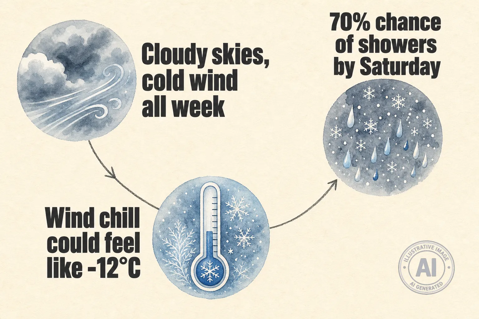
Igloolik, Nunavut, is in for an unsettled week of weather, with cloudy skies, cold winds, and a growing chance of rain and flurries heading into the weekend. Environment Canada’s forecast shows temperatures will struggle to get far above freezing, while brisk winds will make it feel closer to -12°C at times.
As of Tuesday morning, June 2, conditions at the Igloolik Airport were mostly cloudy, with a temperature of -3°C and north-northwest winds of 32 km/h, creating a wind chill of -11. Visibility was good at 24 km, but the cold is expected to hang around all week.
Daytime highs will range from 1°C to 5°C, while overnight lows dip to around -4°C. The main story through mid-week is the wind. Northwest gusts could reach 50 km/h, and when combined with those cool temperatures, it will feel like -12°C during early mornings and nights. Residents heading out for any reason are being urged to dress in layers and cover exposed skin.
The chance of precipitation grows as the week progresses. Friday night brings a 40 percent chance of showers, but by Saturday that jumps to a 70 percent chance. Sunday looks similarly unsettled, with a 60 percent chance of flurries or rain showers. Daytime highs over the weekend should reach 4°C or 5°C, but the damp, cool conditions could make outdoor activities uncomfortable.
For context, a typical June day in Igloolik sees a high of around 1°C and a low near -5°C, based on Environment Canada’s historical climate data. This week’s temperatures are close to those normals, but the wind is stronger than usual for this time of year. The 7-day outlook reflects the kind of changeable, damp weather that often arrives in the high Arctic as winter finally loosens its grip.
Environment Canada has not issued any weather alerts for Igloolik as of Tuesday. In Nunavut, extreme cold warnings are not triggered until temperatures drop to -55°C and stay there for at least two hours—a threshold much lower than in southern Canada, reflecting how local residents are adapted to the cold. While conditions this week don’t come close to that, the mix of wind and moisture can still be risky for anyone spending extended time outdoors.
Anyone planning travel or time on the land should keep an eye on the forecast, especially heading toward Saturday, when showers become more likely and visibility could worsen.
