The Ontario Ministry of Natural Resources has issued a flood warning for the Pembroke district as water levels continue to climb along the Ottawa River. The warning, which remains in effect until April 22, 2026, covers the stretch of the river from Pembroke to Arnprior and follows rising water levels that have already caused road closures and localized flooding throughout the region.
As of 4:00 a.m. on April 21, 2026, water levels at Pembroke reached 112.95 metres. The Ottawa River Regulation Planning Board reports that minor flood levels have been exceeded in areas from Pembroke down to Carillon. Further downstream, major flood levels have already been surpassed from Lake Coulonge to Lake Deschenes. Officials expect water levels to continue rising between Mattawa and Pembroke over the coming days, potentially nearing the peak levels experienced during the 2023 flood.
The Renfrew County and District Health Unit is urging residents to take precautions to protect their health and safety. For those with wells that may have been affected by floodwater, the health unit recommends either using bottled water or bringing tap water to a rolling boil for at least one minute before using it for drinking, food preparation, or brushing teeth.
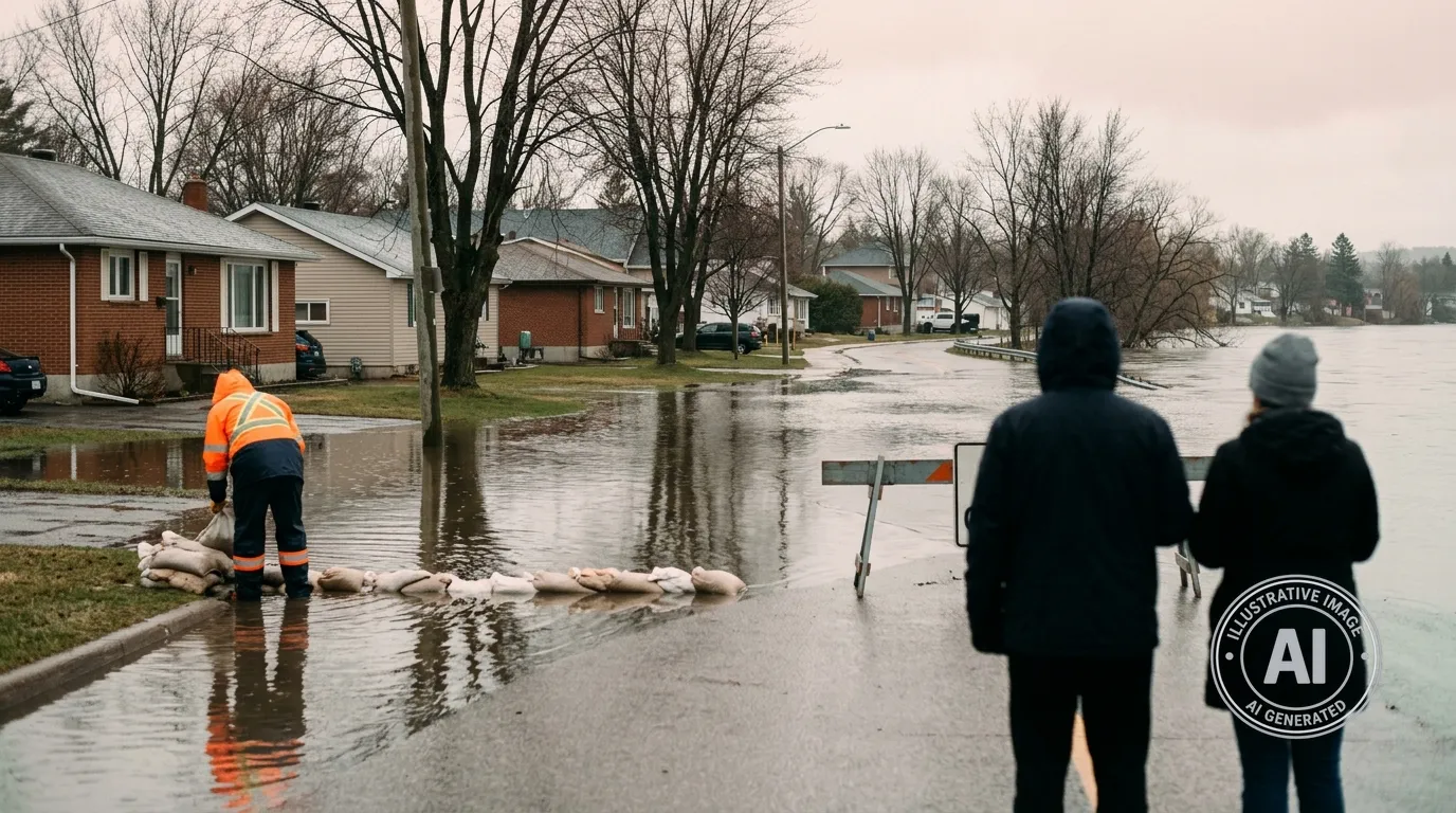
Local infrastructure is already feeling the impact, with road closures reported on Sullivan Point Road in Laurentian Valley, Mclean Avenue in Arnprior, and Rantz Road in Petawawa. Municipalities have established sandbag stations to assist residents in protecting their property. Nearby, the situation led to a state of emergency in Fort Coulonge, Quebec, on April 19, where 70 residents were evacuated after the Coulonge River burst its banks.
Billy Denault, the MPP for Renfrew–Nipissing–Pembroke, stated that his office is in close contact with the Ministry of Natural Resources and Ontario Power Generation to track the situation and ensure that information is shared with local communities as conditions evolve.
