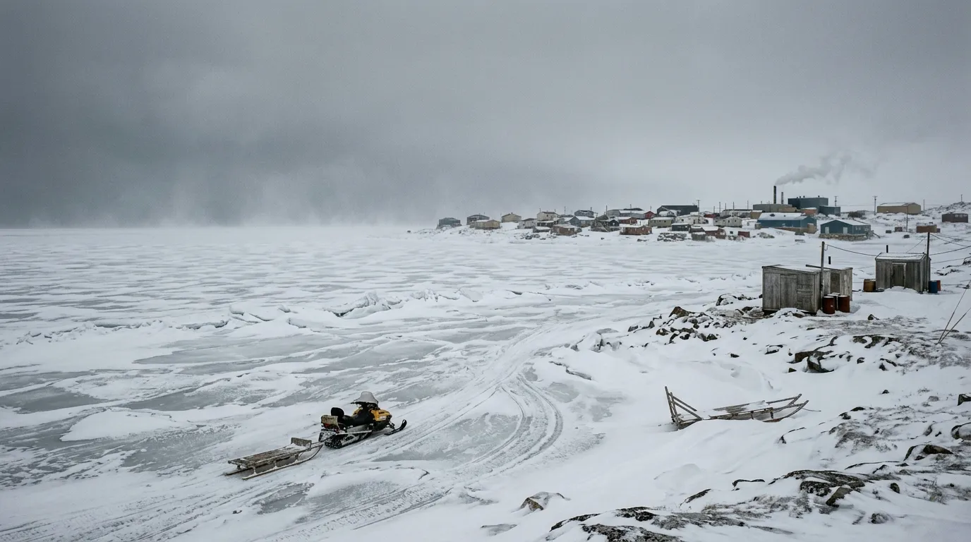
As spring begins in Rankin Inlet, Nunavut, the northern portion of Hudson Bay remains covered in solid ice. While the region is currently experiencing harsh weather, including a blizzard with wind chills reaching -36°C on April 6, 2026, the thick ice serves as a vital component for local movement in a community that lacks all-season road connections.
According to satellite imagery captured between April 4 and April 5, 2026, by the Canadian Ice Service, the area maintains full ice concentration. These observations align with weekly regional charts that confirm consistent ice conditions through the end of March. For residents of this community of 2,975 people, the seasonal freeze typically lasts between seven and nine months, providing a window where ice-based travel is possible.
Because there are no permanent roads connecting Rankin Inlet to other communities, the town relies heavily on air travel for year-round transportation. Although the territorial government has discussed the potential for a road network, such as the proposed Kivalliq Road Project that would connect several coastal communities, such infrastructure does not currently exist.
Experts from the NASA Earth Observatory have noted that the timing of spring ice breakup on Hudson Bay has shifted over the decades, now occurring nearly two weeks earlier than it did prior to 1988. As warmer weather approaches, residents are reminded that the period for travel over the ice will eventually come to a close before the bay becomes ice-free, which generally happens by early August.
Environment Canada continues to monitor these patterns closely. Updated information and daily imagery of the ice concentration remain available to the public as the season progresses.
